I've compiled my first panoramas using some freeware prog, that unfortunately left it's watermark in several places.
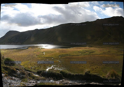
In no particular order, here's a view of the shore of the lake on Day 2, just before we reached the camp site above it at Paredones.
This is near Laguna las Tres Cruces, 2 hours after the start of Day 2, just before we reached the end of our first valley and crossed the ridge into the second one.
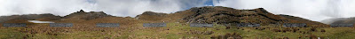
On top of the ridge Ioana and I walked on for two hours. Admittedly, there's a lot of crap in the foreground, so just imagine it was a whole lot better :-)
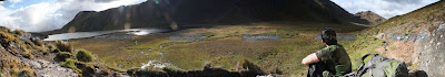
Taking a break on a big rock above the start of the lake which we camped above at the end of Day 2.
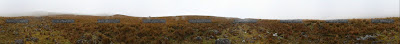
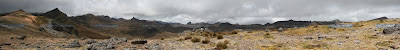
This is probably really hard to discern, unless you've got your computer monitor turned up to full brightness, but it is a 360degree view whilst standing on a part of the Ingañan on Day 3, which had a great number of boulders scattered across its width and paramo all around. The lighter, roughly triangular strip of ground you see in two parts of the picture is the Ingañan. That's what's left of Inca roads after 500 years of use without any maintenance... I'm reminded of working at that GKN site in Spain, but that's another story :-)
That's all for now, folks!
Keine Kommentare:
Kommentar veröffentlichen